|
Martellus Project: Multispectral imaging used to reveal map’s secrets
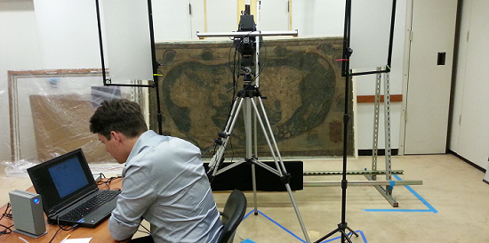
NEW HAVEN, CT, Yale University, August 15, 2014: This week at the Beinecke Rare Book and Manuscript Library, from August 11-19, an interdisciplinary team is at work on a multispectral imaging project to facilitate the study of a 15th century world map by cartographer Henricus Martellus. The map likely influenced Christopher Columbus and is representative of his geographical views.
The map, which is typically on display to the left of the Beinecke’s service desk, has been relatively unexamined following a peak in interest after its acquisition in the 1960s because it is largely illegible. Efforts to image the map in the ‘60s using UV light revealed that the text could be recovered through such techniques, though it was not until the past decade that technology developed that could reveal all of its secrets.

NATIONAL PUBLIC RADIO
September 17, 2014 4:08 PM ET - Multispectral Imaging Could Reveal Secrets Of Martellus Map
A team of researchers are using multispectral imaging to uncover hidden text on a 1491 Martellus map, one of the most important maps in history. Lead researcher Chet Van Duzer thinks the discoveries will allow historians and scholars to see just how the map influenced cartography in its time.
Click here or on image...

WIRED MAGAZINE
09.15.14 6:30 AM - Uncovering Hidden Text on a 500-Year-Old Map That Guided Columbus
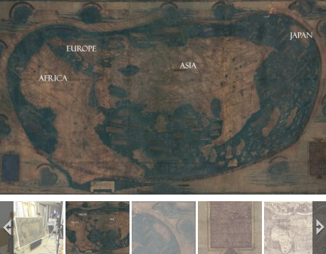
Christopher Columbus probably used the map above as he planned his first voyage across the Atlantic in 1492. It represents much of what Europeans knew about geography on the verge discovering the New World, and it’s packed with text historians would love to read—if only the faded paint and five centuries of wear and tear hadn’t rendered most of it illegible.
But that’s about to change. A team of researchers is using a technique called multispectral imaging to uncover the hidden text. They scanned the map last month at Yale University and expect to start extracting readable text in the next few months, says Chet Van Duzer, an independent map scholar who’s leading the project, which was funded by the National Endowment for the Humanities.
Read more here or click on image...

NATIONAL ENDOWMENT FOR THE HUMANITIES
OCTOBER 7, 2014 | BY MARY DOWNS - Columbus Sailed Here! Multi-Spectral Imaging of an Important 15th Century World Map
In August 2014, an interdisciplinary team of imaging scientists and scholars gathered at Yale University’s Beinecke Rare Book and Manuscript Library to undertake exciting work on a map that in all probability influenced Christopher Columbus’s conception of world geography. Drawn by German cartographer, Henricus Martellus, who was working in Florence, Italy, in about 1491, the map shows the entire world as it was known at the time.
Click here or on image...

THE WEATHER CHANNEL
September 18, 2014 - A research team at Yale has set out to discover hidden text in the Martellus Map. This could be the very map that Christopher Columbus used when he came to America.
Click here or on image...
DAILY MAIL, UK, SCIENCE-TECH:
PUBLISHED: 04:19 EST, 19 September 2014 | UPDATED: 08:57 EST, 22 September 2014
Decoding Columbus’ map: Scans could reveal hidden text on Martellus Atlas and shed light on 15th century civilisations
- The Martellus map helped Christopher Columbus navigate the Atlantic
- But some text on the map, describing regions and people, has faded
- Lazarus Project is using multispectral imaging to uncover hidden text
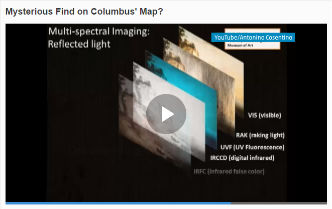
- Technique captures multiple images at specific frequencies of light
- The images are digitally combined and processed in a way that uncovers information otherwise hidden to the naked eye
Read More...
02 - September, 2014
CONTACT: Richard Chang, Support, at MegaVision Corporation, 805-964-1400
Return to News Releases >
|


